
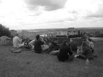

Today we visited the Poitiers battlefield. It was quite an experience to have actually traced the movements of both the Anglo-Gascon and French forces. We began the day at the Nouaille Abbey, which had already been standing for two centuries by the time of the Black Prince’s 1356 campaign. Our first movement focused on tracing one of two possible routes taken by Salisbury in his movement to close the gap in the English lines during the French advance. Our movement took us through the dense Woods of Nouaille onto “the bad road” (Maupertis). We noted that because of the presence of the Nouaille Abbey it is probable that the road we had taken to reach the Poitiers battlefield was present and could have been used by Salisbury - as it made sense for any grain that was grown on the western side of the Nouaille woods to travel through the forest rather that completely around Woods of Nouaille and to the Abbey.
We eventually reached the other side of the Woods of Nouaille and followed the Croix de la Garde road. To check our position we stopped at a farm and entered a field in order to locate a pit that was illustrated on our maps. Although the pit was not found we later noticed its position upon movement south along a road running perpendicular to Croix de la Garde. We observed the hedgerows along the way and noted their height and density. Although not very tall at this particular location, they would have been a formidable obstacle to any advancing French units.
We then proceeded south towards the supposed hilltop where the Black Prince is said to have positioned himself. Moving from the north a hill was not very noticeable but clearly defined when approaching from the south. It was noted that the hilltop was the Black Prince’s anchoring point. We then moved further south and reached the “bowl,” a densely wooded ridgeline that descended into a wetland. We concluded that the English had placed their archers along this ridge and utilized the steepness of the bowl as a way of checking any possible French cavalry charges. The Black prince extended his line from the hilltop to the “bowl.”
Upon completion of touring the “bowl” we proceeded south to the Miosson River, the very river Captal de Buch’s forded in order to attack King Jean’s forces from their rear, a very decisive moment during the battle of Poitiers – one that no doubt sealed English victory. The river was shallow and looked like it could be quickly crossed on horseback, an important note Dr. Roger’s brought up. Quick movement was a necessity, especially with defeat a distinct possibility.
We moved north along the bowl and further examined the steepness of the terrain. The site offered exceptional protection for English archers. Our southern movement along the bad road took us past more hedgerows, in particular the zig-zag hedgerow the English used to halt the French advance. It was here a gap formed in the English lines, one that was filled by Salisbury. Further south was a monument commemorating the battle of Poitiers. It was here that we tried to decide the best possible way to employ forces along severely broken ground – boulders and strangely uneven ground was common throughout the area. Warwick arrayed his men from the bowl to the monument area. It would have been ideal for the Anglo – Gascon forces to break up the advancing French lines, so utilizing the terrain in a manner that would induce this to occur was taken into account. It was decided that a straight line stretching just south of this “bad” terrain would have formed an ideal defense. Warwick’s lines would have extended to the “bowl” where English archers were firing upon French cavalry and Men at Arms.
We walked south and crossed the bridge along the bad road. We moved north to have lunch in the quant town of Poitiers. Although our original plans did not work out, we found a nice pub that served excellent food called the Auberge de Labaie. The food was fantastic and the made for a relaxing lunch where we conversed about what had been learned and sites to come.
Paris

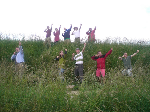
Hotel des Invalides. From the left: Tweeter, Jersey, KAARRLL!, Ty, le #*@%, Doc Rogers, the Duchess, the Sir, Lenny, and Fez
Archers at Crecy
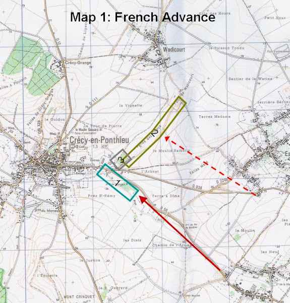
Map 1: French Advance on Crecy
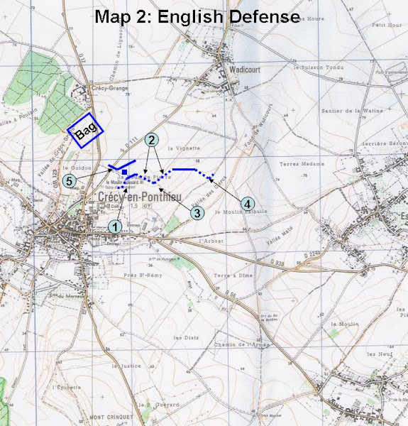
Map 2: English Defense at Crecy
Showing posts with label USMA Class of 2009. Show all posts
Showing posts with label USMA Class of 2009. Show all posts
Saturday, June 14, 2008

Tuesday, June 10, 2008
Day One: Carcassonne
Well our trip is underway and we are in France. We flew out of JFK yesterday evening and landed this morning in Toulouse about 1100 local time. From the airport we got in our two, eight passenger vans and headed out. Our GPS immediately went down and so we had to rely on Marc's navigation skills. He managed to get us out of the city and on the road to Carcassonne. Our trip from Toulouse to Carcassone was filled with some very beautiful terrain. We were traveling down in a valley at the base of the Pyrennes Mountains. From the road we were able to see several large and magnificant churches that appeared to be very old but were clearly the center piece of the small towns. Little did we know what was awaiting us in Carcassonne.
As we approached the town we looked up on the hill and saw a commanding structure. It was the old walled city and castle of Carcassonne. As we walked up to the walls, the only word to describe the structure was "awesome." The city has two main walls and then has several other defences that have been added on from the time it was built in 4th century and then to the rough shape we saw today in the 13th century and then final renovation in 1859. After beginning our cultural immersion with a very French 2 1/2 hour lunch, we were able to walk up in the towers and even into the beautiful cathedral that was built inside the walls in 1214. It is truly one of those places that you have to be standing there to really understand the presence and beauty of the walled city and castle over the river valley below. It was a very magnificent start to our trip and we are looking forward to our many stops to come.
As we approached the town we looked up on the hill and saw a commanding structure. It was the old walled city and castle of Carcassonne. As we walked up to the walls, the only word to describe the structure was "awesome." The city has two main walls and then has several other defences that have been added on from the time it was built in 4th century and then to the rough shape we saw today in the 13th century and then final renovation in 1859. After beginning our cultural immersion with a very French 2 1/2 hour lunch, we were able to walk up in the towers and even into the beautiful cathedral that was built inside the walls in 1214. It is truly one of those places that you have to be standing there to really understand the presence and beauty of the walled city and castle over the river valley below. It was a very magnificent start to our trip and we are looking forward to our many stops to come.
Subscribe to:
Posts (Atom)