
After a long evening of sleeping off our jetlag, we began our first full day in France by getting breakfast at a local patisseire, or bakery. Baguettes in hand, we ascended once more into the fortified city (not a castle, a fact Professor Rogers emphasized repeatedly) of Carcassone. Touring the battlements, we gained an appreciation for the tremendous task taking a town would be, as ten-meter walls look much larger from their base than from the pages of an history book. We also visited a medieval "museum", whose hilariously poor introductary film featuring a jester/mime did not enlighten our understanding of the period as much as we had hoped. It did, however, have three impressive dioramas which detailed the various developmental stages of the city, from Roman frontier town to sought-after medieval stronghold.
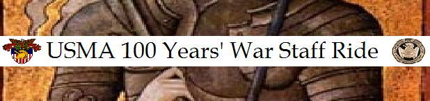
Leaving Carcassone, we began our trip to Aiguillon, the site of a very important siege which the French were forced to abandon in response to the landing of an English invasion force. While we had studied the siege's circumstances in the classroom using Google Earth and contour maps, our visit to the site yielded several interesting insights. The fortification at Aiguillon was placed strategically at the confluence of two rivers, and the riverbanks down to the rivers were much steeper, thereby making them a more formidable defense, than we had anticipated. We also saw some rises which we thought might have been possible foundations for the walls of the bastide.
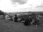
After changing our plans to accomodate slightly longer than expected tours, we set off through the French countryside to Castillon. This final battle of the war featured an attack by an English force led by the famous John Talbot against a heavily entrenched French force which made heavy use of artillery pieces. We were able to trace the French fortifications, as the trench which protected their camp was still easily visible as it was over a meter deep. Walking the field and having our legs torn to shreds by nettles allowed us to understand the difficulty of an assault against the position. We also examined a river and found that the bubbling brook which we had anticipated was not nearly as idyllic as we had assumed, as the stream was bordered by a steep hill.
After a long day of muddied clothing and nearly catastrophic knee injuries, it was excellent to sit down to another delcious French meal with the knowledge that it would be wise to protect one's legs on future battlefield tours with pants so that we leave the battlefield with more memories than scratches.
Paris

Hotel des Invalides. From the left: Tweeter, Jersey, KAARRLL!, Ty, le #*@%, Doc Rogers, the Duchess, the Sir, Lenny, and Fez
Archers at Crecy
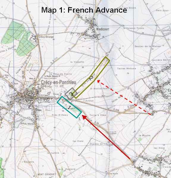
Map 1: French Advance on Crecy
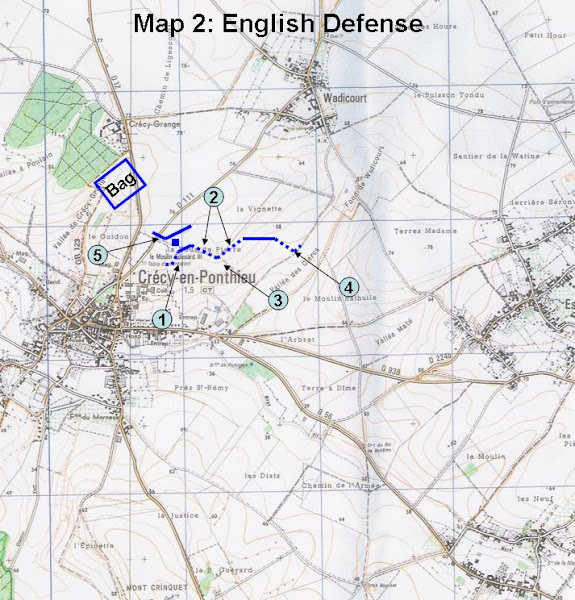
Map 2: English Defense at Crecy
Subscribe to:
Post Comments (Atom)

1 comment:
MAJ Teutsch,
This Blog is terrific with plenty of great insight. I hope you share its success with future staff ride OICs throughout the department. Please post more pictures and pick me up a bottle of Bordeaux!
MAJ Barry
Post a Comment