

Today we began by finishing up Bergerac and traveling to Auberoche to explore that battle site.
In the Battle of Auberoche, the French were laying siege on an English fortification. Meanwhile, an English relief force was camped nearby, waiting for reinforcements in order to attack the French encampment of about 7,000 men. Fearing discovery by the French and low on supplies, the English decided to attack without waiting for reinforcements. Meanwhile, the French were sitting and joking in their camp, complacent after many months of laying siege, and were entirely unprepared for the English attack. First we wanted to determine the exact route of the English from their camp to the French camp, which required the Enlgish to cross the river. Due to their small numbers, only 1,200 men, they were relying on the element of surprise and therefore could not use the bridge due to its proximity to the French town of Le Change. We first traveled to a spot in the river which we determined would be the best fording site. After braving the thick forest of stinging nettles, we made it to the bank of the river. At this point, everyone, except the girls who were prepared to call for help if necessary, stripped down to their swimsuits and began to cross the ferocious (not really) river which came at highest to one’s waist. Thus, this river could easily be forded by the English army, especially if they were on horseback, and since the river would have been lower when they crossed in October 1344.
We then traveled to the site where the English archers were positioned. From the top of the wooded hill, we determined that the archers could move forward without being seen by the French. This wooded hill extended down to the road that served as the west border of the French camp. Upon reaching the road, we decided that, due to the steep slope from the French camp to the road, it would be very difficult for the French cavalry to attack the English archers. Even if the French had created some sort of fence as an additional protective measure, this would have served only to help the English by providing a barrier that would further keep the French from advancing to the road. Professor Rogers also pointed out that presently the hill was very thick with trees and shrubs, but during siege the woods would have been less dense because the French would have used the wood for firewood and setting up their camp.
After walking along this road, we discovered the only route of ingress for the English cavalry to the southern border of the French camp. The hill on the western border was very steep, and there was only one road that went from the road to field. At this point, we also determined that the field where the French camp was would not be quite big enough for 7,000 men and several thousand horses. We decided that it would be possible for the French to have a camp on the eastern side of the river as well, with a bridge connecting the two camps. Meanwhile, with the field only being about 150 yards wide, the 400 English cavalry could line up with 150 men across and 2-3 men deep, allowing them to cover the entire field as they began their attack against the French.
After being brutally attacked by mosquitoes, we headed up to the chapel overlooking the field, the only building remaining from the former Auberoche castle. This castle was created due to its strategic location that allowed it to easily control the river and the main road. There was only one road that led to this castle at the very top of the hill, making the castle very easy to defend. The English at this castle, once they saw the battle commence, opened fire with their archers on the French retreating to the north and pursued them on horseback, as well.
Originally, when we first examined this battle in the classroom through the aid of maps, we were left with many questions. However, having traveled and observed the terrain ourselves, has resolved many of the issues we raised in class.
Paris

Hotel des Invalides. From the left: Tweeter, Jersey, KAARRLL!, Ty, le #*@%, Doc Rogers, the Duchess, the Sir, Lenny, and Fez
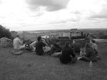
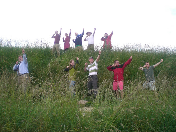
Archers at Crecy
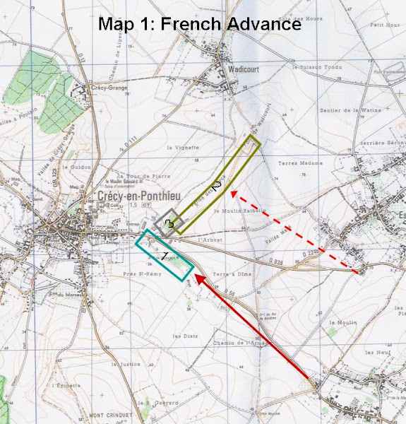
Map 1: French Advance on Crecy
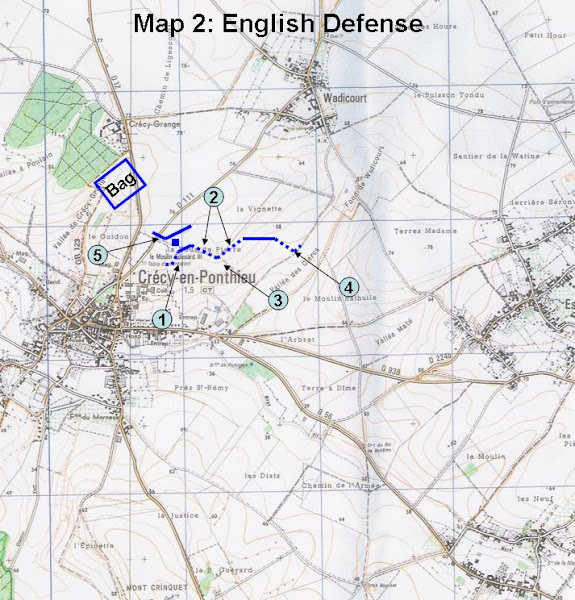
Map 2: English Defense at Crecy
Subscribe to:
Post Comments (Atom)


No comments:
Post a Comment